Maqam sheikh ‘Abdallah
مقام الشيخ عبد الله
קבר שייח' עבדאללה
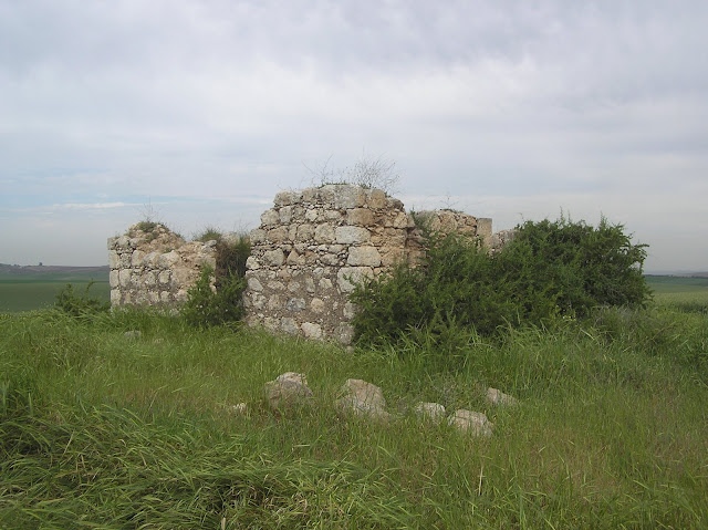
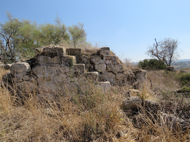
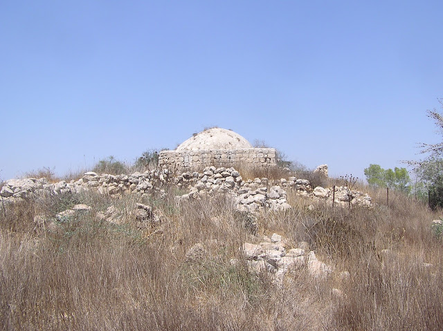
This tomb is not mentioned by researchers of 19–20th centuries, although it is quite a remarkable one. For the first time it appeared on the British maps of Palestine. The maqam is situated on a small hill which is historically known as Khirbet al-Habur (SWP III, 281; Palmer 1881, 371 (Sheet XX)). The tomb with the sizes of 6.90 х 6.75 х 2.10 m with a 1.4 m high cupola has a beautiful arch entrance from the northern side. From the right side from the entrance there is a small window. A steeple-roofed mihrab in a southern wall of the tomb is surrounded by Arabic and Jewish inscriptions made by present-day visitors. The sheikh's cenotaph has not survived.


View from the south-east


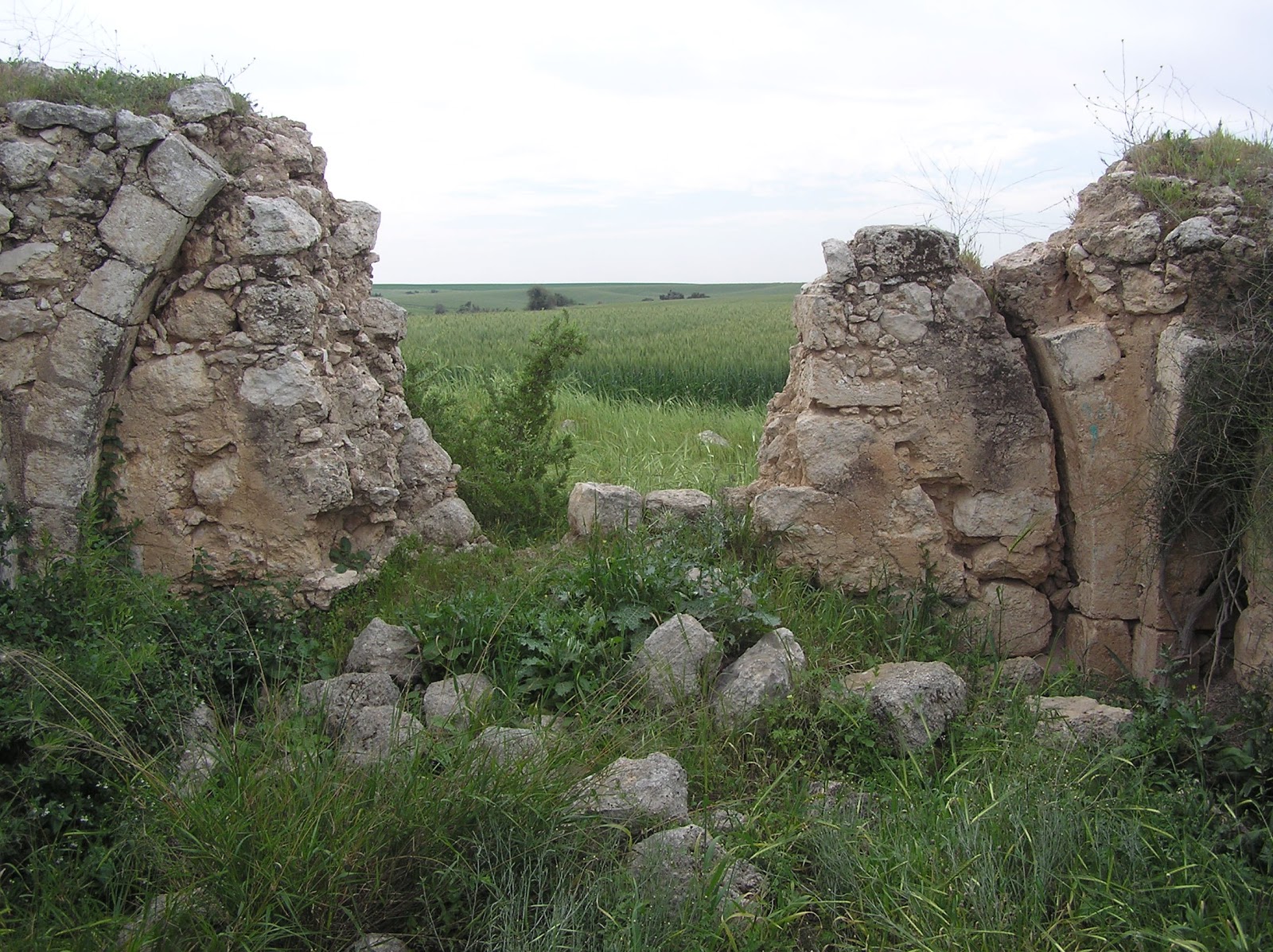
From the eastern side to the maqam there is a small yard surrounded by a wall from which only fragments have been preserved nowadays. In a dozen meters to the West from the maqam the foundation of a rectangular building have been preserved, which function is not clear. Probably, it was a zawiya or a room for pilgrims and travellers.

 Route. The maqam is situated in the Samakh Caves National Park and is seen from Highway 6. Below this Highway a soil road passes which leads from moshav No'am to Cretaceous caves of Samakh close to which a Muslim shrine is located. It is also possible to reach maqam by field roads leading from moshav Lakhish to the West, but these roads are almost unsuitable for cars.
Coordinates: 31°33'13.5"N 34°48'49.5"E
Location of the object on Google Maps
References: SWP III 281; The Archaeological Survey of Israel; iNature: Samakh Caves National Park
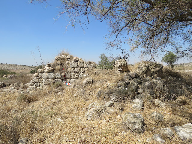
Sheikh Abu Amran (or Abu Imran) was a local saint of Palestinian Arab village Zikrin (Thikrin, Dhikerin), which remains are located to the north-west of kibbutz Beit Nir. The tomb of sheikh Abu Amran is met in E. Palmer's (1881, 273) and H. Stewardson (1888, 137) works. V. Guérin visited Zikrin in 1863 but he did not mention about the local shrine (Judee II 107–108).


Maqam’s ruins are located on a small hill in 700 m to the north-west of Zikrin’s ruins. This is a regular 6.30 х 6.30 m square with a destroyed roof. The biggest height of retained walls – 2.60 m. Wall thickness reaches 0.77 m. An entrance to a maqam from the northern side, in the western side there retained the part of a window. Inside each wall has a big arch roof. In the southern wall there was, probably, a mihrab but in this very place there is a big fracture. It is impossible to determine the location of a cenotaph because the surface of a burial room is filled with debris of crashed walls and a dome.


Route. From Route 353 if we travel 300 m along it to the north of kibbutz Beit Nir, a soil drive road with blue marks goes to the west. We travel along it four and a half kilometers, then we turn right to the road with green marking and we move along it eastwards for approximately one kilometer. In the place where this road makes a turn to the right (to south), in the east we see a field of wheat, behind which a desired maqam is situated. Yes, access to this facility is not easy but there is no better way.
Coordinates: 31°40'21.3"N 34°51'09.5"E
Location of the object on Google Maps
References: Palmer 1881, 273 (Sheet XVI); Stewardson 1888, 137; Khalidi 1992, 228


View from the north-east

View from the north

View from the west

View from the south-east

View from the east

The mihrab

From the eastern side to the maqam there is a small yard surrounded by a wall from which only fragments have been preserved nowadays. In a dozen meters to the West from the maqam the foundation of a rectangular building have been preserved, which function is not clear. Probably, it was a zawiya or a room for pilgrims and travellers.
Structure to the West from the maqam

Plan of maqam

Coordinates: 31°33'13.5"N 34°48'49.5"E
Location of the object on Google Maps
References: SWP III 281; The Archaeological Survey of Israel; iNature: Samakh Caves National Park
Maqam sheikh Abu Amran
مقام الشيخ أبو عمران
קבר שייח' אבו עמרן
Sheikh Abu Amran (or Abu Imran) was a local saint of Palestinian Arab village Zikrin (Thikrin, Dhikerin), which remains are located to the north-west of kibbutz Beit Nir. The tomb of sheikh Abu Amran is met in E. Palmer's (1881, 273) and H. Stewardson (1888, 137) works. V. Guérin visited Zikrin in 1863 but he did not mention about the local shrine (Judee II 107–108).
View from the south


Maqam’s ruins are located on a small hill in 700 m to the north-west of Zikrin’s ruins. This is a regular 6.30 х 6.30 m square with a destroyed roof. The biggest height of retained walls – 2.60 m. Wall thickness reaches 0.77 m. An entrance to a maqam from the northern side, in the western side there retained the part of a window. Inside each wall has a big arch roof. In the southern wall there was, probably, a mihrab but in this very place there is a big fracture. It is impossible to determine the location of a cenotaph because the surface of a burial room is filled with debris of crashed walls and a dome.
View from the south-east

View from the north

Interior. The southern wall
Interior. The eastern wall

Route. From Route 353 if we travel 300 m along it to the north of kibbutz Beit Nir, a soil drive road with blue marks goes to the west. We travel along it four and a half kilometers, then we turn right to the road with green marking and we move along it eastwards for approximately one kilometer. In the place where this road makes a turn to the right (to south), in the east we see a field of wheat, behind which a desired maqam is situated. Yes, access to this facility is not easy but there is no better way.
Coordinates: 31°40'21.3"N 34°51'09.5"E
Location of the object on Google Maps
References: Palmer 1881, 273 (Sheet XVI); Stewardson 1888, 137; Khalidi 1992, 228
Maqam sheikh Abu Fatma
مقام الشيخ ابو فاطمة
קבר שייח' אבו פטמה
C. Conder after visiting the Khirbet Zanoah in 1881 wrote the following description of the maqam: “In the middle of the site is the modern Mukam of Sheikh Abu Fatmeh, with two chambers and a dome. It is kept very clean, and a small broom and a water-bottle hang on the wall. The walls are daubed with mud, with rude sketches of palm leaves, suns, etc. In the niches of the walls jars and pottery lamps are left as offerings” (SWP III 129).
We visited Khirbet Zanoah in 2012 and found only pathetic remnant of its former greatness. The interiors of the sheikh Abu Fatma tomb are filled up with stone fragments, no sign of lamps, jars are long gone. More than modest dimensions of the maqam (3.60 x 2.40 m height is difficult to determine because of the accumulation of debris) make it hard to believe that it had two chambers. To ascertain this a thorough excavation is required. C. Conder says nothing about a mosque built next to the maqam: its ruins remained to the present day. Perhaps, the mosque was built after 1881.


View from the north

View from the east

Route. Khirbet Zanoah is located between Ramat Beit Shemesh A and Route 3855, to the south of Zanoah moshav. Nearby is the high-voltage power line. A 400-meter path leads to the maqam from the main street of Ramat Beit Shemesh.
Visited: 29.07.12
Coordinates: 31°43'07.7"N 35°00'06.2"E
Location of the object on Google Maps
References: SWP III 129; Palmer 1881, 326 (Sheet XVII); Stewardson 1888, 137; The Archaeological Survey of Israel
Maqam sheikh Abu ‘Ubayda
مقام الشيخ أبو عبيدة إبن الجراح
קבר שייח' אבו עוביידה
C. Clermont-Ganneau described this tomb in such way: “On the west side of the village, to the north of the church, there is another Mohammedan sanctuary, which also is greatly venerated. Here stands an ancient and very curious building, with cupolas and vaults. It is called simply Sheikh ‘Obeid. I have no doubt that this otherwise unknown Sheikh ‘Obeid is a sort of pendant to Mu‘adh ben Jabal, and that concealed under it lies the personality of another famous hero of the Mohammedan conquest, who also fell a victim to the Plague of ‘Amwas” (ARP I 493).
C. Clermont-Ganneau confused the tomb of Abu ‘Ubayda with the maqam of Mu‘adh ben Jabal, which is located nearby on the hill; we’ll revert to this maqam later (10. Rebuild Maqams and Modern replicas of Maqams).
C. Clermont-Ganneau confused the tomb of Abu ‘Ubayda with the maqam of Mu‘adh ben Jabal, which is located nearby on the hill; we’ll revert to this maqam later (10. Rebuild Maqams and Modern replicas of Maqams).
Photo of 1920s

Abu ‘Ubayda ‘Amr ibn al-Jarrah was Muhammad’s companion, commanded the troops in Palestine and died of a terrible plague in Emmaus in 639. In Arabic this village was called ‘Imwas. Abu ‘Ubayda was buried in the village cemetery, and the tomb replaced the Roman baths, the rooms of which are still well preserved. The antique foundation of a Muslim shrine was found during the excavation. Roman bath consisted of four interconnected rooms. It is difficult to determine where exactly the cenotaph used to stand since all Muslim decor was eliminated during the excavations.

According to R. Davis, “next to Shaykh ‘Ubayda was a big sidr tree, as old as ‘Imwas. Under its shade the village elders would sit chatting in the evenings and playing seeja [mancala, a board game]” (2011, 167).

The maqam is situated in the Ayalon Park (Canada Park) and stands behind the famous Byzantine church in Emmaus. This place is featured in guidebooks as “Roman Bath”.
Visited: 07.10.11
Coordinates: 31°50'22.6"N 34°59'23.9"E
Location of the object on Google Maps
Wikipedia: Imwas
Maqam sheikh Ahmad al-Misyad
مقام الشيخ أحمد المصيد
קבר שייח' אחמד אל-מסיד
One kilometer away from moshav Agur, if you drive along Road 353 towards Luzit, on the left side of the road there is a tomb of sheikh Ahmad al-Misyad not visible through the trees. In his time V. Guérin called this building: “Oualy dédié à Neby Mesied” (Judee II 104), thinking that it was dedicated to a prophet. That sheikh Ahmad al-Misyad is buried here we learned from studying British maps of Palestine. In Arabic this place is called Khirbet Sufiya.
The structure is quite small, dimensions being 6.4 x 6.1 x 3.1 m. The entrance is on the west side, the east wall has a wide arch. This maqam this has a number of specific features. The burial chamber is located under the floor, there is a separate entrance (more like a manhole) to it outside the tomb. There is a lintel on this manhole, where remained an Arabic inscription. Of all the maqams that we have examined this was the only one with such an underground burial chamber. It might have been a pit or a small cave where the saint had been buried. Another feature is that to the right of the entrance to the tomb there is a stone ring attached to the western wall.


View from the west

View from the north

View from the east

View from the south

Manhole in the south wall and an Arabic inscription on the lintel

Stone ring

Entrance to the maqam (inside view)

The mihrab

The burial chamber

Inside the burial chamber

Fragment of the British map 1945

Travelers and lovers of antiquities, beware: do not try to approach the maqam. Approaches to it are surrounded by sharp stones among thorny bushes, and in the maqam itself there is a hornets' nest on the ceiling. Wasps sting terribly those who enter.
Visited: 31.07.12
Coordinates: 31°41'11.8"N 34°54'42.9"E
Location of the object on Google Maps
References: Guérin, Judee II 104
Maqam sheikh ‘Ali ad-Dawayimi
مقام الشيخ علي الدوايمي
קבר שייח' עלי
Quite a monumental building crowns Giv'at Gad. It was the main cult object for the whole Muslim neighborhood. The number of pilgrims coming here didn’t run low. At first, in the Abbasid period, a maqam was built – a regular cube with sides 7.15 x 7.15 m and height of 5m with rich decorations inside. Here stood the cenotaph (Petersen 2001, 281), which has not survived to our day. During the Mamluk period three rooms were added to the maqam, but their purpose is not completely clear. For convenience, let’s call them rooms B, C (on the north side of the maqam) and D (the west side). Room B with two entrances is an ante-room which leads to the sheikh’s tomb (A) and to the room C. Room D, heavily damaged, has a separate entrance. Near the maqam there is a quite capacious cistern.


Plan of the maqam (from the book by A. Petersen)

Photo of 1993 (from the book by A. Petersen)

According to W. Khalidi, “This shrine had a large courtyard, a number of rooms, and one large hall for prayers, and was surrounded by fig and carob trees and cactuses. It attracted visitors from neighboring villages” (1992, 213).
Muslims developed the custom of painting maqams’ domes green quite recently. C. Conder said that the tomb of sheikh ‘Ali was crowned by a white dome (SWP III 258). Remains of white plaster are still visible on it.
View from the east

View from the north

View from the south

View from the west

Sheikh ‘Ali was born in a wealthy Moroccan family that settled in the Palestinian village ad-Dawayima. The remains of it lie to the east of the maqam, 3 km away, near the modern Israeli settlement Amatzia. Since the tomb dates back to the Abbasid period, and sheikh ‘Ali lived in the Ottoman period, it is likely that the original maqam was dedicated to someone else.
Entrance to the sheikh’s tomb (A)

The mihrab

The reservoir

As the top of the hill where the tomb of sheikh ‘Ali is situated, was chosen by Amatzia residents as a place for recreation and picnics (a number of tables with benches is placed there), the maqam and the reservoir are in a good condition. The Israeli prevent further destruction of the Muslim monument considering it an important landmark. The maqam of sheikh ‘Ali is one of the few abandoned Muslim shrines, which the Israelis somehow take care of.

Route. From the Lachish junction drive along Road 3415, a kilometer short of Amatzia take the right turn in the direction of Giv'at Gad.

Visited: 06.08.12
Coordinates: 31°32'09.9"N 34°53'13.4"E
Location of the object on Google Maps
References: SWP III 258; Palmer 1881, 378 (Sheet XX); Stewardson 1888, 138; Khalidi 1992, 213; Petersen 2001, 280–281
The Archaeological Survey of Israel; iNature: Giv'at Gad Reserve
Maqam sheikh ‘Ali al-Jedira
مقام الشيخ علي
קבר שייח' עלי
C. Conder who visited Khirbet al-Jedira in May 1875 did not notice any Muslim sanctuary, though he mentioned a destroyed tower, rock cistern and three storages with round arches (SWP, III 116). With such a detailed description it is difficult to imagine that the researcher did not distinguish quite a big shrine... if it was there at all at that time. The Maqam of sheikh ‘Ali on Khirbet appears on PEF map (Sheet XVII) and on Palmer's map (1881, 327). Obviously, it was built between 1875 and 1881.
In fact, according to the blockwork, the maqam can be dated with Ottoman period. Probably it was a little mosque.
View from the north

In 1908 R. Macalister described this shrine as follows, “The wely of Sheikh ‘Ali el-Jedireh stands to the north of the ruin, and close to the cistern just described. This shrine is partly ruined, but is an object of devotion, and (as is often the case) firewood and other property is stored there under the sheikh's protection. There is here a pile of timber which is used from year to year by the harvesters, to construct booths for themselves in the fields. Between harvests it is left in the wely, and is perfectly safe from theft. Besides these objects left in trust, there are a number of the usual votive deposits, rags, trinkets, bits of candle, and such-like odds and ends. A fine olive-tree grows inside the enclosure. The building is roofed with a simple barrel vault, in the centre of which rises a low dome. It is not square, as welys usually are, but long and narrow: what is remarkable is, that the long axis lies east and west; that is, at right angles to the orthodox direction of the kiblah. I suspect that it was part of a house belonging to the old settlement, afterwards adapted as a resting-place for the saint” (Quarterly statement, XL 259).
View from the south

The mihrab

It's interesting to know that in the beginning of 20th century this sanctuary was partly destroyed and thought of as an old one. Only the south wall and the mihrab have been saved by present time. The size of the building is 12 x 5 m. The highest south-western corner of the wall is 3.20 m. Inside there is a part of the arched bay in the south-eastern corner. The same bays obviously were in every corner of the building. There is no olive tree inside. There are only bushes on the ruins.
A. Petersen visited this shrine twice, in 1992 and in 1996, and each time he thought that he was on Khirbet as-Safar (or as-Safra), which is located 1 km to the south-east from Khirbet al-Jedira. Anyway, there is no doubt that Petersen made photos and descriptions of the maqam of sheikh ‘Ali al-Jedira, “The building is largely ruined and only the south wall survives to its original height (approximately 3 m) although. The out lines of the other walls can be discerned (all the walls are approximately 0.5 m wide). The south wall is nearly 12 m long… The prayer hall was approximately 4 m wide with a doorway in the middle of the north wall, opposite the mihrab” (2001, 268). And this is not the only inaccurate location in the respective Oxford edition.
The arched bay in the south-eastern corner

Route. The maqam is located 200 m south from Highway 3, near the junction Nahshon, beside the asphalt road. But you can reach the maqam only through kibbutz Nahshon when you drive down from the junction the to read leading to the kibbutz.
Coordinates: 31°49'41.4"N 34°57'39.2"E
Location of the object on Google Maps
References: SWP, III 116; Palmer 1881, 327 (Sheet XVII); Quarterly statement, XL 259; Petersen 2001, 268; NIG 2001, X 71
Maqam sheikh Muhammad al-Jezari
مقام الشيخ محمد الجزاري
קבר שייח' מוחמד אל-ג'זארי
An observation point is arranged on the roof of the tomb of sheikh Muhammad for tourists visiting Tel Gezer. Next to the stairs, which lead to the roof of the Muslim shrine, there is a plate that says: “This structure is a remnant of a sheikh's tomb, apparently built before the year 1600 BC. It is believed to be the tomb of Sheikh Mohammed al-Jazarli (sic!), in whose name the ancient word Gezer is preserved. This tomb was sacred to the inhabitants of Abu Shusha, a small village that was located on the southwestern side of the tell.”


Photo of 1905 (from the book by R. Macalister)

R. Macalister, who excavated Tel Gezer in the early 20th century, described this tomb: “They are perpetuated in the dome-crowned shrines which still stand on the highest hill-tops of Palestine. Probably there is not a landscape in the country which does not include such a sanctuary; a little plain square stone building, the chief interest of which centres in a tomb, as did that of its ancient Canaanite predecessor. Under the strange but thin disguise of a Muslim sheikh some ancient Canaanite spirit of fertility is here still worshipped. A mihrab or prayer niche points the way to Mecca, and the true believer, as he prostrates himself before it, still turns himself toward the ancient pagan fetish, the Black Stone, which has survived the Prophet's assault on the faith of his fathers, and still almost insolently dominates the new faith which he founded” (1925, 273).
Actually, there is little left of the maqam (7.5 x 5.0 m) itself. The dome of the shrine is dismantled, and the tomb is covered with soil. A large arched entrance on the west side once led to the burial room. As we can judge by this entrance, the floor of the room is at a depth of at least 1 meter from the present surface. In his time C. Conder described the maqam of sheikh Muhammad al-Jezari as “a modern building surrounded by a small graveyard” (SWP II 432). This message obviously contradicts the date of the maqam construction, presented on the plate for the tourists. In 1902, the tomb was already dilapidated. It’s written in the Quarterly statement: “the village cemetery, and a small half-ruined wely or shrine of the local saint” (XXXIV 231). The cemetery, which once surrounded the tomb, was completely destroyed in the course of archaeological excavations. Nothing remained of the sacred tree that grew in front of the tomb.
View from the north

View from the west

View from the east

View from the west. Entrance to the maqam


Visited: 10.10.11
Coordinates: 31°51'35.6"N 34°55'10.3"E
Location of the object on Google Maps
References: SWP II 428, 432; Palmer 1881, 273 (Sheet XVI); Baedeker 1882, 145; Stewardson 1888, 139; Geikie 1888, I 66; Guide to the Holy Land 1888, 103; Quarterly statement IV 40; Quarterly statement VII 74; Macalister 1925, 273; NIG 2001, X 139; iNature: Tel Gezer Park
Maqam sheikh as-Salihi
مقام الشيخ الصالحي
קבר שייח' אל-סליחי
In Picturesque Palestine (1881–1884) there is a drawing of Wady as-Sunt or the Valley of Elah (Wilson III 157). In the foreground we can see the hill on the top of which a maqam stands. Perhaps this is the tomb of sheikh as-Salihi, that has remained to the present day. As-Salihi was a person in attendance of Sultan Salah ad-Din (Saladin).

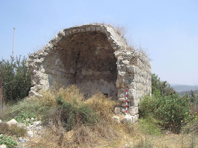
The maqam has a classic shape: square structure with a dome. The massive walls are wider than 1m. The entrance is on the north side. A cenotaph didn't survive. A mihrab of 0.50 m deep in the south wall has an arched vault. The upper part of the mihrab masonry crumbled away slightly, causing a small hole being formed in the wall.


View from north-west

View from the north


View from the south

The mihrab

Visited: 15.08.18

Video of 2018
Route. Along Road 375, between junctions Adullam and ha-'Ela. From the parking lot between the hills towards the tomb as-Salihi leads the road 4x4.
Visited: 15.08.18
Coordinates: 31°40'58.4"N 34°57'59.0"E
Location of the object on Google Maps
Addition: Panorama
Maqam sheikh ash-Shannawi
مقام الشيخ الشنّاوي
קבר שייח' שנוואני
The tomb of sheikh ash-Shannawi, i.g. holy Palestinian village Beit Shanna is not mentioned by the explorers of the 19th century. Firstly it is marked on the British maps of Palestine. Probably, this tomb was built in the early 19th century. It is located on Khirbet Beit Shanna, southwards from Modi'in.
Though the maqam is relatively new, the structure is quite ancient. The fragments of columns in the wall show that. The Muslim shrine might be built on the place of a Byzantine chapel.


Some time ago chairs, cutlery, sleeping accessorizes appeared in the tomb. A folded staircase stands in the mihrab, Jewish religious literature is on the shelf.
It is not clear whether it was an attempt to Judaize the Muslim shrine. Can it repeat the destiny of the tomb of Nabi Sheman which became the tomb of Simeon, the son of Jacob, and the maqam of sheikh al-Gharbawi which turned to be the tomb of Mattathias Hasmonean? (See Chapter 12. Maqams that were Judaized)


Route. Now the maqam is not easy to find, as it is almost hidden in mastic trees. You can reach the tomb via a track road, going from the Highway along Modi'in. You should climb 300 m up the hill to reach the structure.
Though the maqam is relatively new, the structure is quite ancient. The fragments of columns in the wall show that. The Muslim shrine might be built on the place of a Byzantine chapel.
View from the north

Photo of 1990 (from the book by W. Khalidi)

Some time ago chairs, cutlery, sleeping accessorizes appeared in the tomb. A folded staircase stands in the mihrab, Jewish religious literature is on the shelf.
It is not clear whether it was an attempt to Judaize the Muslim shrine. Can it repeat the destiny of the tomb of Nabi Sheman which became the tomb of Simeon, the son of Jacob, and the maqam of sheikh al-Gharbawi which turned to be the tomb of Mattathias Hasmonean? (See Chapter 12. Maqams that were Judaized)
The maqam's interior

The fragments of columns in the wall

Route. Now the maqam is not easy to find, as it is almost hidden in mastic trees. You can reach the tomb via a track road, going from the Highway along Modi'in. You should climb 300 m up the hill to reach the structure.
Maqam sheikh Suleiman
مقام الشيخ سليمان
קבר שייח' סולימן


“The wely of sheikh Suleiman is located amidst huge quite old ruins”, tells Saulcy (1867, 68). In old times the road from Jaffa to Jerusalem laid a bit south-eastwards from Highway 1, through al-Qubab, similar to current Route 424. But the white dome of the tomb of sheikh Suleiman was observable even from there. “On the left there are the remains of a Roman road and one more wely or santon – sheikh Suleiman on Kafr Tab”, adds Le Guide (1877, 277).
The shrine was has been looked after by the resident of Palestinian village al-Qubab until 1948. The destruction of the sanctuary started obviously after July 1948, when the Israeli took control over this territory. In 2006 Israeli archeologists proceeded excavations on Hurvat Kfar Tov looking for Jewish antiquities, and the Muslim shrine being destroyed was not the matter of their interest.
View from the south

A small walled yard. View from the south

View from the west

Now the maqam keeps being destroyed, its walls have been saved only by one fourth. But even these ruins make you understand how significant the former building was. The inner walls have the same arched design as we usually see in Palestinian maqams.
The size of the maqam is 7.40 x 7.40 m. Bad destructions of the south wall make it impossible to find a mihrab. Outside of the northern wall there adjoin stone steps, which were used to climb up the roof of the maqam.
The maqam's interior

The maqam's interior. South wall

View from the north

A small walled yard borders to the west from the maqam. Its size is 7.50 x 10.60 m and in the northern part it a bit overcomes the border of the maqam. Visitors came into the yard through the gates in the south wall, and then through the doorway in the western wall on the maqam they reached the Burial chamber.
Route. The maqam is located in 400 m from Highway 1, on Hurvat Kfar Tov. You can reach it via a track road from Highway 431 through Industrial zone Merkaz Einav.

Visited: 06.08.18
Coordinates: 31°52'46.8"N 34°57'30.2"E
Location of the object on Google Maps
Maqam sheikh ‘Usheish (‘Abdallah)
مقام الشيخ عشيش
קבר שייח' סולימן
On the map of Palestine Exploration Fund (Sheet XX) this maqam is called Sh. ‘Abdallah and is located on Khirbet Umm ‘Osheish; and on the British map of Palestine of 1941 this maqam is identified as Sh. ‘Usheish, located on Khirbet ‘Usheish. We can surmise that in fact sheikh’s name was ‘Abdallah [related to] Khirbet ‘Usheish (Umm ‘Osheish). Judging by the C. Conder’s remark (SWP III 287), in the 19th century Khirbet was already uninhabited; the maqam, however, apparently still was a functioning shrine. Some work in the maqam was carried out in the 20th century. Probably the shrine was kept in order by the Palestinian residents of the village Deir Nakhkhas, which was situated at a distance of 1.3 kilometers to the west of Khirbet ‘Usheish on a Height 321.
Maqam on the maps of Palestine of 1879 and 1941

Khirbet ‘Usheish and the Maqam of sheikh ‘Abdallah do not appear in the works of T. Canaan, W. Khalidi, A. Petersen and other researchers. Some modern Arab-Palestinian writers mentioned the tomb of sheikh of ‘Usheish in connection with the ruins of Deir Nakhkhas.


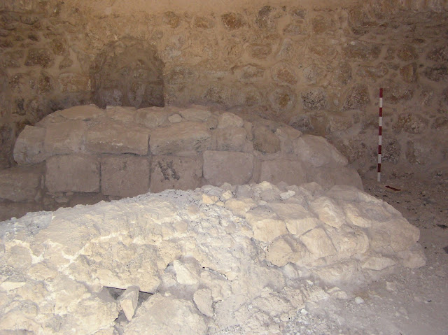
It's a rather curious structure. The tomb of sheikh was once surrounded by a set of rooms; only ruins are left them now. However, the tomb itself (7.80 x 7.30 x 2.90 m) is in a relatively good condition. The entrance is on the north side. In front of the entrance there is the remnant of a large arch. On the left side of the entrance to the tomb there is a small protrusion from the wall with a recess at the top – probably for an oil lamp. Inside there are two cenotaphs (sheikh's wife might have been buried together with him), mihrab and a tiny window in the west wall. There is no graffiti. The entire complex leaves an impression of a once important religious object.
View from the east

View from the north-east

View from the north


View from the south-east

View from the south-west

Small protrusion from the north wall

The remnant of a large arch

Interior

Window in the west wall

Plan of the maqam

Route. From the Guvrin road junction drive along Highway 35, 3 km short of the Tarqumia checkpoint take the right turn near the water tower to the road 4x4, leading to the peak of Ezro'a. The required maqam is situated on this peak.

Only one half of the Mount Ezro'a covered with trees – they were planted on the side that relates to Highway 35. Therefore the passing motorists don't see the maqam. The other side of the Mount Ezro'a is completely “bald”, and from this side the maqam of sheikh ‘Usheish can be seen from afar. But this side there has no passable roads.
Video of 2018
Visited: 06.08.12; 15.08.18
Coordinates: 31°36'39.1"N 34°56'00.6"E
Location of the object on Google Maps
Maqam sheikh Zeid
مقام الشيخ زيد
קבר שייח' זיד
A dilapidated building in the former Palestinian village Beit Jiz has every indication of a maqam: the structure is of almost cubic shape, small in size (5.24 x 4.85 x 3.20 m), with a typical dome. A low entrance, mihrab of one meter high and a tiny window in the east wall create even stronger impression of a burial place, a tomb. The state of the western part of the building (it’s badly damaged) and heaps of stone fragments make it impossible to ascertain whether a cenotaph used to stand in front of the mihrab. A. Petersen expressed such thought: “There is no trace of a tomb or cenotaph although this could have been on the west side of the chamber which is now covered with collapsed rubble from the west wall (this may also account for the off-centre position of mihrab and doorway).” (2001, 123) Note, however, that Petersen gives the wrong dimensions of the maqam: 3.5 x 3.5 m.


View from the west

View from the east

Entrance in the north side

The mihrab

Plan of the maqam (from the book by A. Petersen)

Arab sources do not mention this object. C. Conder definitely states the presence of the maqam in Beit Jiz (SWP III 108). The maqam of sheikh Zeid is closely connected with Beit Jiz (Palmer 1881, 329). “In either case, – says M. Sharon – the saint's name belongs to local legend and has no historical roots. Like other rural sanctuaries, the maqam is a square room with a simple dome, which can still be seen near the modern kibbutz Harel.” (CIAP II 145)
M. Sharon also says: “The stone with an inscription was found accidentally near the maqam during construction work in the area between 1972–1973. It could have belonged to the sanctuary or brought to it at some later date. Whichever is the case, the inscription is the only evidence for the existence of Muslim activity in the site in the Islamic period». The inscription on the stone reads: «Basmalah. From what has been reconstructed during the term of office of the emir Sayf ad-Din Aqul by the hand of Baktimur the mamluk of ‘Alam ad-Din, (who is) the pulpit of benevolence and blessing. Reconstructed in the month of Dhu al-Qa'dah, the year 735 (=June-July 1334).”
Route. The former Arab village Beit Jiz is situated on Derech Burma, but on its very unpresentable, impassable part. The easiest way to travel is from Harel kibbutz to the farm adjacent to Beit Jiz. Maqam is situated a few meters away from the fence surrounding the farm. But such route makes it impossible to approach the maqam. So you can try it another way. At first you should reach Mitzpe Harel. You can get there by turning to the paved road from Highway 44 between Ta'oz moshav and Harel kibbutz and driving along it. From Mitzpe Harel follow the Derech Burma signs, and, after driving for about a kilometer along a rather bad road, you’ll come across the same farm; leave the car in front of an abandoned mansion and walk about 200 meters to the left (west) along the path until you reach the required maqam. This path also leaves much to be desired.
Those who'll dare to complete this difficult journey will be rewarded with the opportunity to explore the abandoned mansion, located to the east of the maqam and the farm. It was built by Palestinian Arabs, later others tried to rebuild it and adapt for some other purposes, but it did not work out. Splendid mansion is still abandoned. Israelis call it Beit ha-Kshatot (“House of the Arches”). Here are some pictures of it:


Visited: 02.08.12
Coordinates: 31°48'44.7"N 34°57'09.8"E
Location of the object on Google Maps
References: SWP III 108; Palmer 1881, 329 (Sheet XVII); Stewardson 1888, 140; Sharon, CIAP II 145; Petersen 2001, 123–124
Maqam al-Hajj Salim
مقام الحاج سالم
קבר אל-חאג' סלים
Three out of four shrines of the former Palestinian village Beit Jibrin have been identified. These include Maqam nabi Jibrin (see Section 2 Tombs of the Prophets), tomb of sheikh Tamim ad-Dari and tomb of sheikh Mas‘ud (see Section 10 Rebuild Maqams and Modern replicas of Maqams). Another Muslim shrine is located on a hill, to the west of Beit Jibrin's ruins. It is surrounded by trees, high bush and is not visible from highway roads. It is not mentioned by researchers of 19–20th centuries. W. Khalidi considers this object as an unidentified shrine (1992, 211). Let's try to identify it. On the 1879 map of the Palestine Exploration Fund (Sheet XX) a Muslim object appears in this place: al-Hajj Salim. The same designation in a German variant – el-Haddsch Salim – we encounter on the 1918 Map of Deutschen Palästina Vereins (HQ 78). It is clear that this name refers not to “Mukhtar’s house” and not to the "House of sisters" which are located on the same hill but which were built after 1918. The only object which in 1879 and in 1918 could have had this name is this shrine. A man who committed pilgrimage to Mecca has the title al-Hajj[i] (Palmer 1881, 367 (Sheet XX)).
View from the east

Fragment of the PEF map

Fragment of the 1918 German map of Palestine

This is quite a curious object. Its sizes: 4.40 х 4.00 х 1.70 m (without a dome). A fragment of a plate with an Arab inscription lies on the maqam's roof. It is not clear where this plate came from. Inside a maqam there are many interesting objects. There is a deep hole in a floor before a mihrab in a southern wall. This is the work of some amateur treasure-seekers. They opened the shrine's floor and in the eastern side at the depth of one meter they found a small tunnel leading to an ancient burial chamber. It is unknown how many treasures were brought away from there. A small underground funeral which is now blocked by stones was found on the western side.
View from the south

View from the south-west

View from the north

A fragment of a plate with an Arab inscription lies on the maqam's roof.

The mihrab

There is a deep hole in a floor before a mihrab

A small tunnel leading to an ancient burial chamber

Route. The maqam is situated to the south of so called the “Mukhtar's House”, in 100 meters to the west from a ticket office of the Beit Guvrin National Park. This Muslim shrine lies outside the National Park and thus it is not visited by tourists. No path leads to it.

Video of 2018
Visited: 15.08.18
Coordinates: 31°36'19.3"N 34°53'29.3"E
Coordinates: 31°36'19.3"N 34°53'29.3"E
Location of the object on Google Maps
Great post with such detailed description of these amazing historical mosques and sites. Isareal is a home to many historical places that have religious significance in the history.
ReplyDelete