Wednesday, December 16, 2020

“Mount of Paradise” – “Mount of Franks” – “Herodium”

“The mountain of the Little Paradise” – “The Mountain of the Franks” – “Herodion”: three traditions of one place

The Palestinian monuments are remarkable for being much more durable than historic periods, epochs and even civilizations. Peoples and cultures change, they endow these monuments with their own narrative, completely different from previous. Things which were told about this or that site before, withdraw into the shadow or disappear. There is no doubt that this process will continue further, and something which is being told us today about a certain monument, will be said differently in the future.

In this article we will consider the cultural aspects of one of the most picturesque Palestinian mountains, which for centuries has been attracting travelers, researchers, and still keeps being in the center of attention. We will study different traditions concerning this mountain in their chronological order. The plenty of historical literature on this topic makes it possible to trace all the peripetias of the culturological process.

The Arabic tradition

South of Jerusalem 12 kilometres (7.5 mi) and south-east of Bethlehem 5 kilometres (3.1 mi) lies a picturesque cone-shaped volcanic mountain. At its top there are the ruins of an ancient fortress. The local Arab inhabitants call it almost poetically Jebel el-Fureidis (جبل الفرديس), which is usually translated as “the Mountain of the Little Paradise”. It might be taken as an earthly Paradise.

The author of this article visited this mountain in October, 2010, accompanied with an Israeli guide; and since that time he has been carefully taking the historical evidence about this landmark.

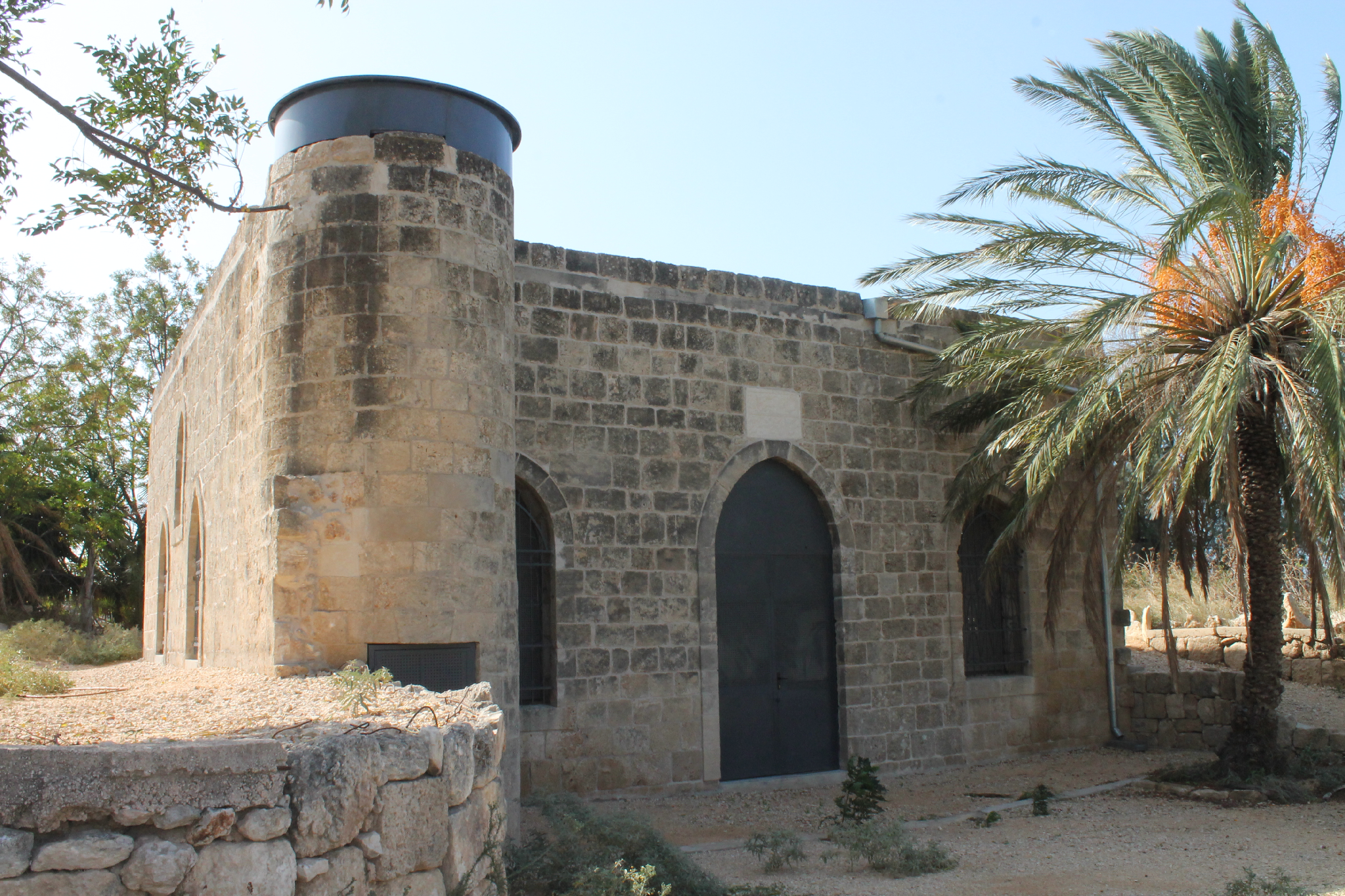
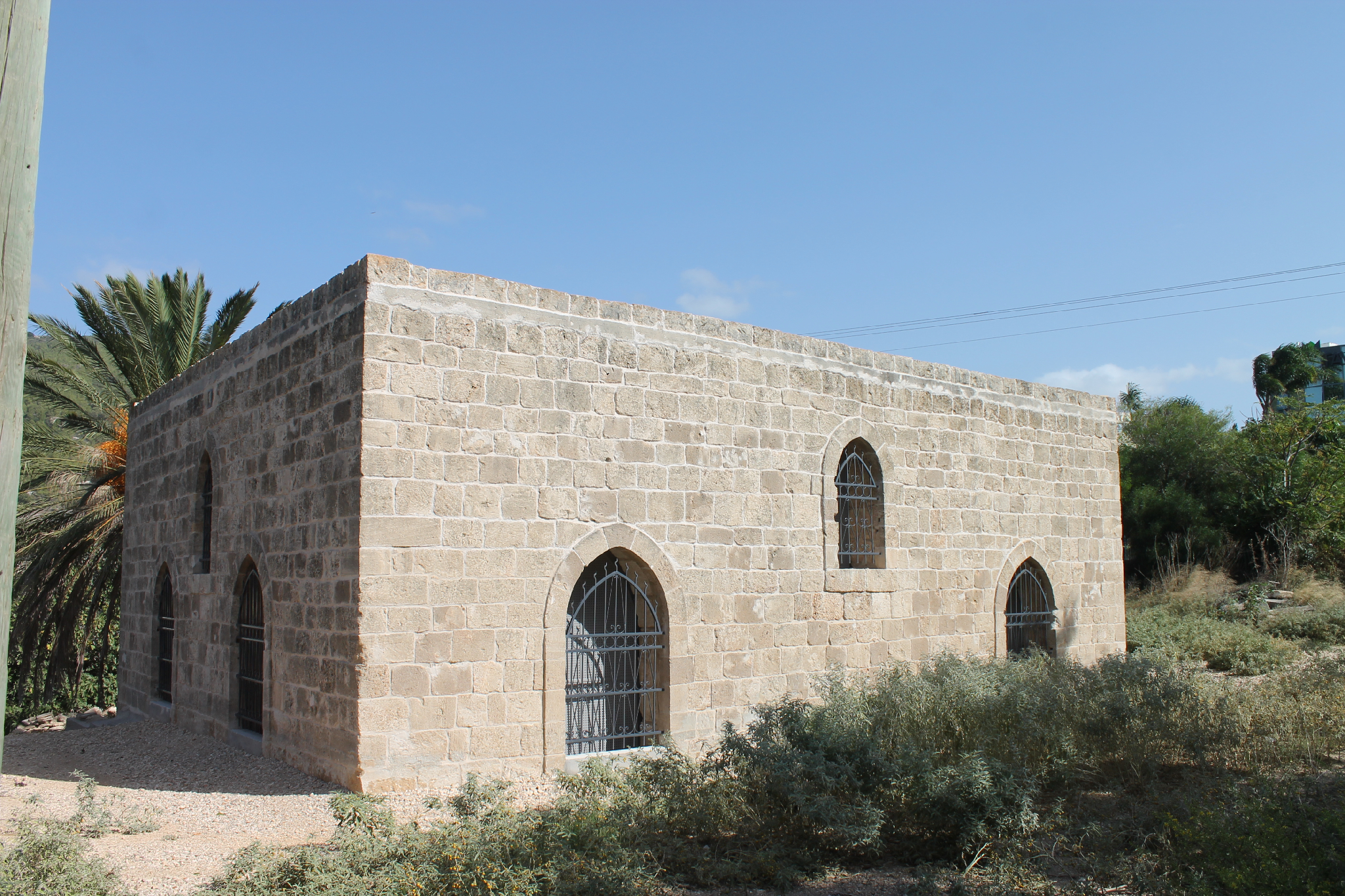
Jebel el-Fureidis nowadays. Now the mountain and the adjacent area make the Israeli National Park “Har Herodion” (הר הרודיון).

An Arabic word “el-Fureidis” is plural of “Firdous”, which means “paradise” or “the gardens” (Le Strange 1890: 439). This word has Persian roots adopted by the Arabs. In the Middle aged Damascus, the one of the city gates adjoined to the quarter with gardens were called “Faradis”. The people of Syria very often call the vineyards and the gardens by the name “Firdous”.

In his book, Nasir Khusraw told that in 1047 he went from Jerusalem to Hebron. “Along the road leading south you can see many villages surrounded by cultivated fields and gardens. Trees that do not need to be watered such as vines, fig trees, olive trees and sumach grow randomly and plentifully there. In two parasang distance from Jerusalem there is a place where you can see the spring, vineyards and gardens. The charm of this place gave it the name of Faradis" (1881: 98–99).

In the Middle Ages this area was one of the most picturesque and ambrosial places in Palestine. European travelers supported the words of Nasir Khusraw: “The name of "the Little Paradise," which the place still bears, may have arisen from the beauty of the gardens, no less than of the town (i.e. the remains of the buildings at the foot of the mountain)” (Geikie 1888: 242; Fulton 1900: 282). “The preserved man-made terraces to the north and north-west, at the foot of the mountain and its slopes bear evidence of the former tree and orchard crops” (Schick 1880: 89).

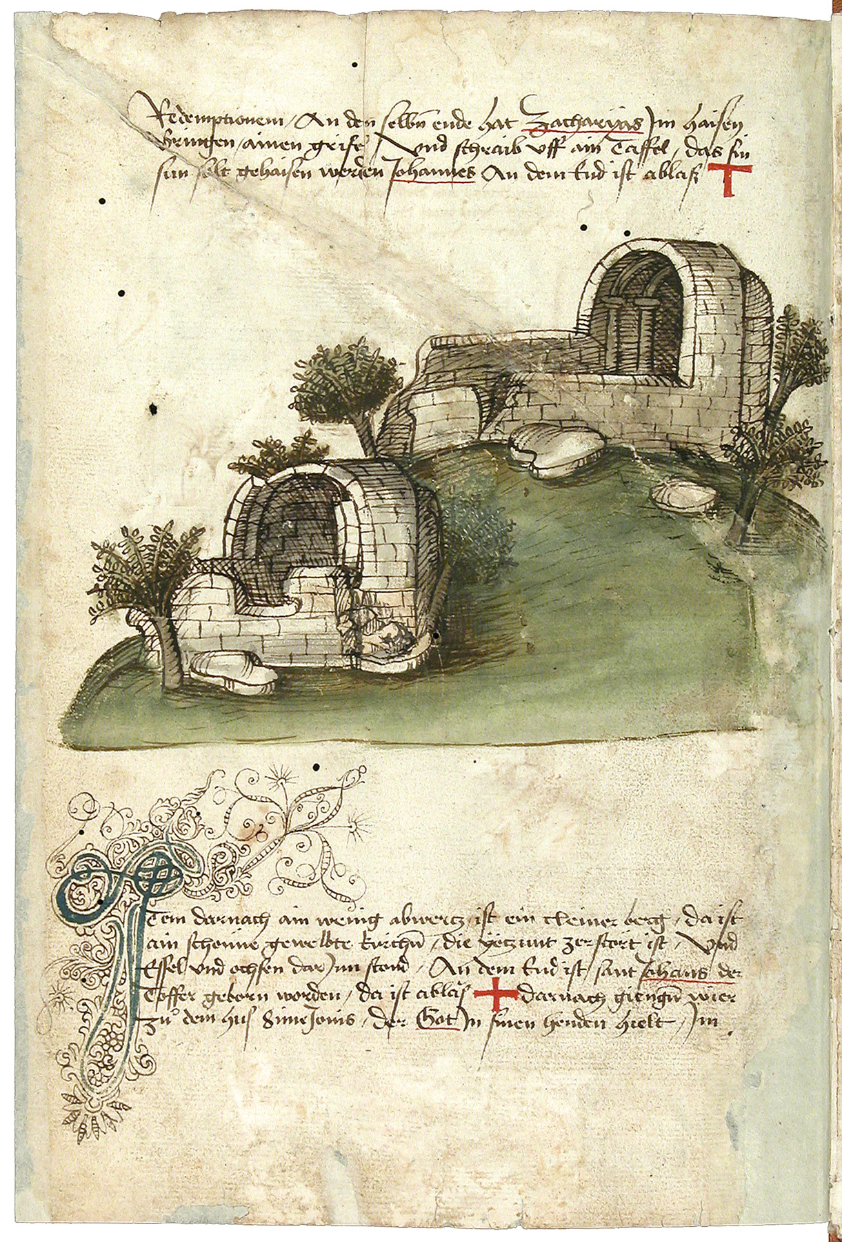
In 18th and 19th centuries European visitors wrote about the terraces on the slopes of Jebel el-Fureidis. These terraces are clearly visible in the drawing in the book of Richard Pococke dated 1745 (see below). Today, these terraces are nowhere to be seen: they were either filled up during Israeli archaeological excavations, or hidden by hiking trails and a spiral road leading to the top of the mountain.

The cone-shaped mountain towering in the middle of the gardens was visible from afar and inspired a reverent attitude towards itself. The Arabs monitored the condition of the mountain and protected it the best they could. In any case, when curious European guests climbed to the top and examined the ruins of the fortress, the local sheikh came himself or sent people to see that foreigners were not digging for treasure (Saulcy 1865: I 176).

View of Jebel el-Fureidis from Bethlehem. 19th century drawing (Wilson 1881: I 137)

Sometimes it came to clashes between locals and foreigners. The Jesuit missionary Michel Nau describes such a scene in 1674: “A little more than one league from Bethlehem, we reached the foot of a high mountain, which is separated from all the others. I have heard that it is called the Mountain of Franks; but in the local village it is called Ferdays or Ferdaous, that is, Paradise. We rode the horses until the rise rate forced us to dismount to climb to the top. Then two or three Arabs, seeing us and not knowing that our company was headed by the [French] Ambassador himself, started shouting at us, forbidding us to go further. Seeing that no one was embarrassed by what they were shouting, they began to throw large stones from the top of that place, which jumped and rolled down the slope with frantic speed and would certainly have killed or knocked over whoever they hit. We managed to dodge them, and then our dragomen quickly rushed to them (to the Arabs), prevented them from continuing, and then we peacefully reached the peak” (1757: 439).

The locals acted this way, since they considered themselves as guardians of this sacred mountain, been called to protect it from the encroachments of foreigners and infidels. The harshness and ferocity with which fellahs sometimes defended their shrines was well known in Palestine and beyond.

Tuesday, June 23, 2020

Haram area in Jerusalem. Southern Wall, 7–12

(Continued. Start)

Aerial photo of the Southern Wall of the Haram esh-Sharif. The dashed lines show the borders between the wall rows of different historical periods. The numbers mark different places of interest, which will be described below.

7. A Latin inscription on the ashlar

Near the Double Gate in the Southern Wall, in the Umayyad rows there is a reused stone block with the Emperor Antoninus Pius mentioned on it. A Latin inscription which is turned upside down and with regular abbreviations says:

TITO AEL HADRIANO
ANTONINO AUG PIO
P P PONTIF AUGUR
D D
To Titus Ael[ius] Hadrianus
Antoninus Aug[ustus] Pius
the F[ather] of the F[atherland], Pontif[ex], Augur
D[ecreed] by the D[ecurions]

A reused stone block with Latin inscription

In the photo there is a Roman ashlar which we turned to make the Latin inscription readable

L. F. de Saulcy was the first who published this inscription in 1853 (III 1853, Pl. XXIV). Researchers suppose not without reason that this ashlar originally belonged to the basement of Antonius Pius monument, which was set within the Temple of Jupiter by a Decurions decree of Aelia Capitolina. In 333 the Pilgrim of Bordeaux mentioned two monuments of Emperor Hadrian. Researchers think one of these monuments was honored to Hadrian's successor, Antoninus Puis who continued the construction of Aelia Capitolina.

In the CIIP, where the inscription follows number 718, it is reported that «the stone block is inserted, upside down, high in the Southern wall of the Umayyad palace on the Haram (Temple Mount).» This is an inaccuracy. This ashlar is located directly in the Southern Wall of the Haram, and not in the southern wall of the Umayyad Palace. In addition, the Umayyad palace itself is not located on the territory of the Haram, but outside. This inaccuracy entailed a following  reasoning in the CIIP: «it since the findspot of the base high in the southern wall of the Umayyad palace on the Haram need not imply that the statue itself was originally erected on the Temple Mount» (CIIP I.2: 18). This is partly true: the statue was not necessarily located on the territory of the current Haram. But the indication of the Pilgrim of Bordeaux to two imperial statues in this territory makes such a location very probable.

Umayyad builders extracted this ashlar from the ruins dated to Aelia Capitolina period and used it in their wall course as an ordinary stone block. Whereas they didn't give any value to the inscription of “infidel Francs” didn’t wanted anybody who would visit the Haram esh-Sharif to read this turned upside down writing.

In the meantime, this ashlar has a great historical value. It should be in the museum dedicated to Aelia Capitolina. But there is no such museum in Jerusalem, and nobody intends to establish it. The commanding Templar school doesn't need such museum, it has another purposes.

One cannot say that the Roman period in history of Jerusalem doesn't interest researchers at all. Recently there appear more and more works about Aelia Capitolina: Belayche 1997, Magness 2000, Bieberstein 2007, Friedheim 2007, Mazar 2011, Newman 2014, Janczewski 2016 are among them. Not long ago an Israeli researcher and archeologist Shlomit Weksler-Bdolah released a detailed book: “Aelia Capitolina – Jerusalem in the Roman Period” (2019).

Nevertheless about three centuries of history of the Holy City are still least studied. It is besides the fact that the foundation of the Old City like the Haram esh-Sharif was established precisely in the Roman period, and all further construction continued and developed Aelia Capitolina. A big amount of Latin inscriptions of that period testifies that the city was thoroughly Romanized (Weksler-Bdolah 2019: 201). For a long time, even in Byzantine period, the city's official name was still Aelia. This name in the form of “Iliyā” (إلياء) was transferred to Muslim rulers of the city (El-Awaisi 2011).


8. The Triple Gate

From the Double to the Triple Gate there is a modern pavement for comfort of visitors of the Archeological park (Baruch and Reich 2016: Fig. 11). This pavement ends with a platform and a stairway near the Triple Gate, which is 80 m from the Double Gate and 90 m from the south-eastern corner of the Haram Complex. The width of the Triple Gate (three arches altogether) is 20,7 m.

The name of the Triple Gate during the early Muslim period is not very much clear. Dan Bahat supposes that Ibn al-Faqih called it the Gate of the Valley (Bab al-Wadi), Nasir Khusraw named it the Gate of the Spring (Bab al-'Ain), al-MaqdisiMihrab Maryam Gates (Bahat 1996, 76–78). But none of the Muslim resources mentioned that there is an underground passage in this place, like the one from the Gate of the Prophet (the Double Gate).

 The Triple Gate

Sunday, June 14, 2020

Haram area in Jerusalem. Southern Wall, 1–6

Aerial photo of the Southern Wall of the Haram esh-Sharif. The dashed lines show the borders between the wall rows of different historical periods. The numbers mark different places of interest, which will be described below.

1. Initial masonry Wall

When moving along the Southern Wall eastwards from the south-western corner of the Haram area, it takes a few meters to get to the modern stairs which lead us 3–4 meters higher than the basement of the ancient wall placed on the solid rock. However, during the archeological research the archeologists got the lowest level of the wall standing of the solid rock. Later Israeli organizers of the Archaeological park in Ophel set the stairs and a wooden flooring, to make it easier for tourists and visitors to climb up to the old pavement after the stairs.

South-western corner of the Haram esh-Sharif

The lower layers of the wall of the Haram esh-Sharif wall through a narrow opening between the wooden flooring and the ancient Haram platform

Anyway, the organizers of the park left observable the lower layers of the wall of the Haram esh-Sharif wall through a narrow opening between the wooden flooring and the ancient Haram platform.  In the photo: we are standing over this narrow opening and watching stone blocks below at the foot of the wall. These are huge roughly dressed ashlars laying lower than the exemplary Herodian blocks. But it should be Herodian blocks (if we follow a common version) which made the original courses of the Haram walls! Especially since the southern part of the esplanade is considered as the Herodian expansion of the Hasmonean Temple.

We could stop the excursion at this point as we eye witnessed that the original courses of the Southern Wall is not Herodian. But we didn't come to the Southern Wall to argue with the commanding archeological school and contradict its fallacies (see: Haram area (“Temple Mount”) in Jerusalem: The Origin), but to study this wall. Thus let's get down to our research.

Benjamin Mazar reports that «we found below the estimated level of the sidewalk two rows of stone chambers built in the flood. In the easternmost part, we even found a blocked hole between the two rows, while another hole was a little higher, leading to the next chamber to the east, to the “Double Gate”. Here we came to two conclusions: these chambers were built as a continuous row along the entire length of this part of the south wall» (1970: 54). These chambers were closed and cannot be seen.
Excavations of B. Mazar at the western part of the Southern Wall (before the discovery of the so-called “Trumpeting Place inscription”) (Mazar 1970: 53)


2. The old pavement

The old pavement 2.5–3 meters wide saved by the organizers of the Archeological park is stretching along the Southern Wall from the south-western corner up to the fortification (Keep) wall. The pavement consists of flags and stones of different size. One cart could move on this road, but two oncoming carts could not get past each other.

The old pavement is stretching along the Southern Wall from the south-western corner up to the fortification (Keep) wall

Charles Warren comments this place as follows, «At the southwest angle, and for at least 90 feet along the south wall, we have found a second and less ancient pavement. It is about 20 feet above the first pavement, and about 23 feet below the present surface; it is nearly on a level with the sill of the Prophet's Gateway, and with what appears to have been an old surface under Wilson's Arch... It was under this pavement that the signet "of Haggai, the son of Shebaniah," was found in 1867; and in another shaft at the southwest' angle we have found several fragments of pottery at a depth of about 5 feet below the pavement. Among the fragments are several Greek lamps, one of which has an inscription of Christian origin, similar to those on lamps which have been considered to be of the third or fourth centuries» (1871: 95).

Warren was wrong when dated the pavement 3–4th centuries. He was misled by Christian artefacts, which were found not on the pavement itself, but somewhere away from it. Modern archeological excavations put the things right. As the lower course of the Umayyad palaces lays 3-4 meters lower of this pavement, it should be dated Mamluks times or even Ottoman period.

Southern Wall of the Haram esh-Sharif (photo of 1931)

Until 1967 the pavement along the Southern Wall was covered with earth and bushes and wasn't in use during a few centuries.

Tuesday, May 19, 2020

Haram area (“Temple Mount”) in Jerusalem: The Origin

I am starting a series of publication about the main sanctuary of Jerusalem, the third top Islamic sanctuary (after Mecca and Medina) — the Haram esh-Sharif. First of all, let's have a look at the walls around the Holy place depicting the most of its centuries-old history of this unique construction. We'll start with the Southern Wall, the shortest (281 m), but the most important in the Muslim tradition.

The statigraphy of different stages how the walls of the Haram esh-Sharif were constructed

Even Charles Warren noticed that a part of the Southern Wall westward from the Double Gate looked less ancient compared to other parts (Warren 1871: 92). In fact, the Southern Wall is 80 or even 85 % a Muslim construction. A few rows of reddish ashlars were built in the period of the Umayyads. Above there are some courses of the same reddish stone blocks of a smaller size (probably from the same quarry); this is a construction of the Mamluks times. More higher there is a courses of the Ottoman period, with small sites of construction works which were carried out in the 20th century.

«The recent excavations at the Southern Wall, carried out by B. Mazar, disclosed signs of five periods of construction, — comments Menashe Harel, an Israeli author. — The lower courses are Herodian, with the characteristic fine dressing, double margin and slightly prominent smooth boss. Next are the large blocks, smoothly dressed, apparently dating to Aelia Capitolina. These are surmounted by smaller, smooth stones, alternating with discs (cross-sections of columns inserted in the wall), which are probably Mameluke. This section is interspersed with small blocks having very prominent bosses and margins, apparently Crusader. The final courses arc of small stones of later periods. The wall at the south-western corner was 37 m high, and the height of the south-eastern wall was 52 m» (2004: 228).

At the Western Wall Harel also notices that «Four courses of smooth blocks (apparently from the time of Aelia Capitolina) are visible above the Herodian courses and the wall is surmounted by seventeen courses of small stones of a much later date» (2004: 244).

We should sort out this identification of cources of different historical periods. Harel probably skipped the cources of the Umayyads in his description. It was a period building boom of the Haram area as well as the palaces nearby. Right over the lowest rows of the original cources, which Harel referred to the Herodian times, he described “big, smoothly dressed blocks”, i.e. a few rows of big reddish ashlars dated to the Roman period. It is undoubtedly a mistake! Many modern archeologists refuse this identification, even those who support the Herodian wall basement of the Haram esh-Sharif.

The south-western corner of the Haram esh-Sharif.
Image from the book of Pierotti (1864 II Plate XXI)

Let's mention one more time that over the rows of big reddish blocks there are the rows of the same reddish blocks, taken from the same quarry, but of a smaller size. Both these constructions are closely connected to each other. The cources that is referred to the Romans by Harel, is actually built in the Umayyads times. As for the smaller reddish ashlars, they are for sure the Mamluks construction, as Harel said.

The big reddish blocks being mistakably referred to the Roman construction, show a perfect example of one ashlar with a Latin inscription which was inserted into the row of the reddish blocks near the Double Gate at the Southern Wall (see: No. 7). How could it happen that a roman ashlar of the statue basement of the Emperor Antoninus Pius got into the wall of the Haram area? It could happen only in case if this ashlar was used for the second time as a construction material taken from the ruins of a Roman city. Thus, it wasn't Roman who built the reddish blocks, it was the builders of the following historic period.

Generally speaking, the vertical “stratigraphy” of the walls’ building stages of the Haram is a subject of an endless discussion starting from 19th century. At one time, Warren dated these courses as follows: «1. The large stones with marginal drafts. Epoch from Solomon to Herod Agrippa. 2. The large plain dressed stones, from Hadrian to Justinian. 3. The medium plain dressed stones, sixth to eighth centuries. 4. The small stones with marginal drafts and projecting faces, ninth to twelfth centuries. 5. Small stones of various description, recent» (1884: 175).

«The heavy protruding boss ashlars on the Eastern Wall north of the seam, usually dated to the Hasmonean period; the magnificent large paneled ashlars of the Herodian extension; the smaller smooth ashlars of the Umayyad reconstruction; the diagonally comb-chiseled Crusader stones; the small stones with a heavy boss of the Middle Ages (Ayyubid to Mamluk periods); the stones with pecked surface and rough margins of Sultan Suleiman’s rebuilding of the city walls; and various repairs of the wall including the extensive renovations using small stones, following the collapse of part of the Eastern Wall in the winter of 1881», — reports Jon Seligman (2007: 38).

In fact, only the date of the lower rows of the wall in the Haram area is questionable, as the complex itself was built in the Umayyads times. But the lower cources has a few rows of well-fitted to each other ashlars dressed in the tradition of the Herodian times. The majority of researchers and archeologists, who transferred the views of Crusaders and Templars to the Haram esh-Sharif, referred this original rows to the Second Temple period and credited he construction to Herod the Great and his successors. It is known that Crusaders declared that the Muslim Haram is the Temple of Solomon or the Jerusalem Temple.

Though a long time ago the Christians had a location of the ancient Templum Salomonis of the current Haram complex, and that was evidenced by the Pilgrim of Bordeaux, Pilgrim Arculf, and succeeding Christian pilgrims.

This location was transferred from the Christians to the Muslims, those who built the Haram esh-Sharif. A Persian poet Nasir Khusraw described Qubbat as-Sakhrah (The Dome of the Rock) in his book “Safarnama” and noted that «Solomon, upon him be peace! seeing that the rock (of the Sakhrah) was the Qiblah point, built a Mosque round about the rock, whereby the rock stood in the midst of the Mosque» (Safarnama, p. 71). And he also commented the Al-Aqsa Mosque, «It is said, however, that the building was accomplished by Solomon, the son of David, peace be upon him!» (p. 76). Though the Muslim readers of Nasir Khusraw did not perceive this Mosque as the ancient Jewish Temple of Solomon described in the Bible, the name of Solomon itself (in Islam: Suleiman the prophet) was associated with Qubbat as-Sakhrah and Al-Aqsa built by the Umayyads, and thus gave grounds for the Crusaders to treat these dictums as a reference to Templum Salomonis.

The Christians had a location of the ancient Templum Salomonis of the current Haram area. The 19th-century lithograph depicts Haram esh-Sharif and follows the inscription: Temple of Solomon.

Friday, January 11, 2019

18. Muslim shrines in Palestinian Authority


Maqam nabi Yaqin
مقام النبي ياقين
המקאם נבי יקין

The fact that a maqam is not obligatory a burial place of a saint, but also can be dedicated to any historical or biblical event, is proved by the maqam of nabi Yaqin in the Palestinian village Bani Na'im, to the east from Hebron.

Village Bani Na'im and its suburbs since the very beginning are connected with tales about a Quranic prophet Lut (Biblical Lot). In the center of the village there is a tomb of nabi Lut (nowadays a mosque), mentioned even by Blessed Jerome in the 4th century and well-known for Middle age geographers. A tomb of Lut's daughters is located not far away.

The maqam of nabi Yaqin (i.e. the True Prophet") is located 2 km to the south from the village on a high mountain with a picturesque view to the Hebron Plateau and the waters of the Dead Sea. A local legend has it that nabi Lut prayed in this place, leaving his footprints on top of the cliff. In the Middle Ages, the Arabs called the Dead Sea Buhayrat Lut.

View from the north

View from the east

Another tradition connects this place with the Quranic prophet Ibrahim (Biblical Abraham), who in Islam is often called the brother of Lut. According to the Arab geographer al-Maqdisi, it was in this place that Ibrahim stood and watched from the top of the mountain the death of “the cities of Lut,” Sodom and Gomorrah, and this is his feet imprinted on a rock. Then Ibrahim admitted Divine justice, saying: “This is an undeniable truth” (hàdhà huwa al-haqq al-yaqin) (Sharon, CIAP II 15), 18. Hence the name of the shrine: the maqam of nabi Yaqin.

"It was in this place that Abraham begged the Divine Grace to have mercy on Sodom,” says Victor Guérin, “from here, the day after Abraham held this mysterious conversation with the Lord, this patriarch from afar witnessed the fire of Sodom and Gomorrah, whom devoured fire from heaven” (Judée, III 158).

View from the north-east

The maqam includes a rectangular courtyard 31 x 22 m, surrounded by a low stone wall, which is entered from the northern side through an arched passage. To the left of the entrance to the courtyard is a water header. In the south-western corner of the courtyard there is a small building without a dome, which is entered on the eastern side. The building is well restored, but apparently, it has a fairly respectable age. Above the entrance to the building in a hollow flaunts an Arabic inscription of the Ottoman period, which reads:

«In the name of Allah the Merciful the Gracious!” We find help in Him. My success (luck) is only in Allah. There is no god but Allah, and our Lord [Muhammad] is the Apostle ("more than the prophet") of Allah. In the name of Allah; what Allah wants. My lord Lut is the apostle of Allah. There is neither power nor power except Allah» (Sharon, CIAP II 18).

This is probably a prayer or part of a prayer, which is prescribed for incoming pilgrims.

The Arabic inscription

Sunday, November 18, 2018

16. Muslim shrines in Lod

In 1930s there were two mosques and 14 Muslim shrines in Arabic city Ludd (Hebrew: Lod). Now both mosques continue to function, but 5 out of 14 shrines survived.

Arabic city Ludd. Photo of 1932


Mashhad sheikh ‘Abd ar-Rahman ibn ‘Awf
مشهد الشيخ عبد الرحمن بن عوف
קבר שייח' עבד אל-רחמן בן עוף

‘Abd ar-Rahman ibn ‘Awf was one of the companions (ashabs) of Muhammad the Prophet. According to the tradition, he died in Medina and was buried in al-Baqi‘ cemetery. But the Muslims who lived in Palestine believed that Ibn ‘Awf was buried on their land, and they even built a mashhad (a shrine) in his honor to the east from the city of Ludd. An Arabic explorer Mudjir ad-Din mentioned this shrine (1496): “Near Ludd from the eastern side there is a mashhad, the the tomb of Abu Muhammad ‘Abd ar-Rahman ibn ‘Aouf, the companion [of Muhammad], a supporter who died in 32 of Hegira” (Sauvaire 1876, 211).

Now the mashhad  Ibn ‘Awf is on the territory of an old Muslim cemetery. Almost nothing left from the Mamluk's building. A modern Prayer house is built on its basement, and only a green dome of the survived shrine marks the place where the cenotaph of Ibn ‘Awf is.


Route. This Muslim shrine is located in the eastern part of Lod, at the entrance to the city by Route 443 or via street ha-Hashmonaim.

Visited: 12.08.15
Coordinates: 31°57'16.4"N 34°54'18.2"E
Location of the object on Google Maps


Maqam sheikh Ibrahim as-Suwayq
مقام الشيخ ابراهيم
קבר שייח' איברהים

In the center of Lod, on Hashmonaim street (Route 443) there is an old Muslim cemetery; very untidy and neglected, despite the fact that it is under protection. Near the entrance to the cemetery stands Maqam sheikh Ibrahim nearly all covered with ivy. Only the north wall with a wide arch doesn’t have ivy on it. A. Petersen visited the maqam in 1994 and described it so: “The maqam consists of a rectangular cross-vaulted structure (4m x 4m) with a small dome in the top. The east face is open and there are windows in the north and south sides. The outlines of a grave or cenotaph can be seen outlined on the floor. An inscription dated to 1119 H. (1706–1707 CE) on the exterior of the building states that this is the tomb of Shaykh Ibrahim Suwayq” (2001, 209).

The old Muslim cemetery of Lod


Photo of 1994 (from the book by A. Petersen)
The exact dimensions of the structure are 4.66 x 4.50m. The entrance to the maqam is not on the east, but on the north-east side, where a wide arch is present. There is an inscription in Arabic on the north wall, however, to the right of the entrance. Dome of the maqam, apparently, completely covered with ivy. Note also that the tomb has no mihrab. Not so long ago the maqam was whitewashed and its floors were tiled. A modern tombstone with an inscription in Arabic “Muhammad al-Mabtuli” was installed instead of the cenotaph. Note that the Mosque of sheikh Ibrahim al-Matbuli (d. 1472), known even to researchers of the 19th century (Palmer 1881, 273; Stewardson 1888, 139), is located on the Tel Ashdod.

Wednesday, November 14, 2018

14c. Abandoned Mosques. Golan Heights


Mosque in Kafr ‘Aqab
مسجد في كفر عقاب
מסגד בכפר עקיב

According to the photos made just after the Six-Days War in 1967, the mosque in Kafr ‘Aqab stood in the middle of the village. Now there is only a basement of the mosque and 1–1.5 m high walls on the hill. Almost nothing left from the minaret.

Photo of 1968

View from the south

View from the south-west

Route. On 20th km turn from Highway 92 to moshav Ramot and in 250 m to the left there is a hill with the ruins of Kafr ‘Aqab village.

Visited: 21.08.15
Coordinates: 32°51'46.4"N 35°39'16.1"E
Location of the object on Google Maps


Mosque in Khushniya
مسجد في الخشنية
מסגד בחושניה

This mosque is observable for all who take Highway 87 and pass a former Syrian (Cherkess) village Khushniya, as the mosque stands right near the road. It was built just before the Six-Days War and now is the only object left after Khushniya. The mosque is often made photos of due to its beautiful minaret with two rounded balconies.

The building is relatively safe, besides the south-western corner, which was destroyed during the 1967 war. The south wall with the mihrab is covered with Arabic and Jewish inscriptions left by modern visitors.

View from the north

View from the south

Thursday, November 8, 2018

14b. Abandoned Mosques. North


Mosque in ‘Amqa
مسجد في عمقا
מסגד בעמקה

The exterior of this mosque looks like the mosque in al-Ghabisiya (see next): the same beautiful three-arched portique (riwaq), approximately the same size of the Prayer hall decorated with high arched curves. Obviously, the mosque in ‘Amqa was built in the 19th century too. As in other villages of the Upper Galilee, the Druzes lived in ‘Amqa.

View from the north

  View from the north-west

Photo of 1990s

In September 1991, the mosque was studied by A. Petersen and made a detailed description, “This structure is located at the highest point of the rocky hillside on which the village was built. It is the only surviving building from the Arab village with the exception of a schoolroom now used as a warehouse (Khalidi 1992, 5).

The mosque consists of a domed prayer hall and an open portico (riwaq) divided into three cross-vaulted bays, each open to the north. The portico also has an open arch at the east end and a rectangular window at the west end. The area in front of the portico (now overgrown) was an open paved courtyard containing a deep cistern in the middle.

The prayer hall is entered through a doorway in the centre of the portico. Its hall is a large square room with massive corner piers supporting the springing of the dome. The interior is lit by a pair of windows on the west and east sides and windows either side of the main door. The area between the piers form wide recesses covered with tall arches. There is a small concave mihrab set into the south wall, slightly to the left (east) of centre, possibly to accommodate the minbar (now vanished) on the west side.

The dome rests directly on the pendentives without the intervention of a drum. The roof of the building is reached by a set of steps within the thickness of the west wall. The staircase is entered from a doorway set into the exterior of the west wall. The exterior of the dome and the flat parts of the roof are coated in a thick grey waterproof plaster. The lower part of the dome has near vertical sides whilst the upper portion has a shallow slightly pointed form. The entire structure is built out of ashlar masonry with a white plaster coating on the interior” (2001, 93).

Entrance to the mosque

Mihrab in the south wall

Western wall


The dome

Over 25 years the abandoned mosque looks quite the same way. Only the destruction process speeded up: the entrance to the Prayer hall is damaged, the east wall partly collapsed, as well as a mihrab in the south wall. Though the damages are not disastrous, the monument is in danger. The fallen wreckage with rubbish are heaped in front of the entrance to the mosque.

From time to time the organization Zochrot organizes excursions for refugees and their descendants in village ‘Amqa. Though we did not see any Muslim traces in the mosque.

Route. There is a turn from Highway 70 to a road leading to Israeli settlement ‘Amqa. You should pass the settlement till the eastern suburbs where there stands the abandoned mosque on the waste land.


Visited: 20.08.15
Coordinates: 32°58'38.2"N 35°10'05.0"E
Location of the object on Google Maps


Mosque in al-Bassa
مسجد في البصة‎ا
מסגד בבצת

A. Petersen commented this mosque as follows, “This appears to be a fairly modern construction, probably built in the early 1900s. It consists of a tall square room with a flat roof supported by iron girders. At the north-east corner is a short cylindrical minaret. There are tall pointed windows on all four sides and a mihrab in the middle of the south wall. At present the building is used as a sheep pen” (2001, 111).

View from the north

View from the south-east

Now this moque is located in the Industrial zone Shlomi, 50 m to the west from Maqam al-Khidr (see Section 7. Maqams. Galilee and the Golan Heights). In the the 1990s there was also a sheep pen, now the mosque is used like it was meant for. The Muslims restored it, installed a gutter, put a lock on the door and totally enclosed all the windows with iron bars and curtains. The majority of time the mosque is blocked. Only sometimes when Muslim pilgrims come there, the mosque is open and a prayer is exercised there. 

Friday, November 2, 2018

11b. Lost shrines. North


Only one out of 24 Muslim shrines (including Bedouin ones), which G. Schumacher saw in the Golan Heights, remained intact till present time. It is the shrine of sheikh Marzuk (see Chapter 7. Maqams. Galilee and the Golan Heights). The other shrines vanished completely.

A huge building of the Tomb of sheikh (or nabi) Abu an-Nida topped a volcanic Mount called Avital. This shrine was seen by J. L. Burckhardt in 1812 (1822, 314). The mountain in Arabic is called Tell Abu an-Nida. “Nida” means “dew”.

G. Schumacher described the tomb as follows, “The highest point of the Tell takes in the large Wely, or Makam Abu en-Neda. This is 38 feet long, 21 feet broad, 8 feet high, and has two whitewashed cupolas that can be seen in the whole country. The sepulcher of the great Moslem saint lies enveloped in silken cloth in the southern division of the building. In the afternoon the view from this Makam is magnificent, but in the morning thick misty clouds arise from the crater and obscure the whole country till 10 o'clock in the morning” (1888, 249). The mountain Received such mane due to this morning humidity.

There is also a curious piece of antiquity to be found on the roof of the Wely Abu en-Neda, viz., the peculiar image, 2 feet 3 inches high, of a bird, which is fashioned in basalt, and reminds one of Egyptian or Persian art. Unfortunately the head is wanting.” (1888, 250).

A picture from G. Schumacher's book

Fragment of the map of 1913

Tomb [of nabi] Abu an-Nida. Photo of 1968

The tomb [of nabi] Abu an-Nida has been probably existing up tot he Six-Days War in 1967, when the Golans Heights weere captured by Israel .Since then an Israeli military base has been established on the top of Tell Abu an-Nida, with mine fields around it. Anyway, according to military reports about the Golans during the Yom Kippur War in 1973, – the Musim shrine wasn`t mentioned in the descriptions of the Israeli positions in Tell Abu an-Nida.

Now the access to Mount Avital is blocked by Israeli officers. When looking at the top of the mountain which is densely built with military structures, one may think it is unlikely that something from the previous times could be saved.

Coordinates: 33°06'30.9"N 35°47'38.3"E
Location of the object on Google Maps
References: Burckhardt 1822, 314; Schumacher 1888, 194, 249–251; Palästina-Vereins IX, 351; The Archaeological Survey of Israel; iNature: Mount Avital Nature Reserve

Mount Avital. Photo of 1967

Mount Avital

On Mount Peres (Arabic: Tell al-Faras) there also was a Muslim shrine – the Tomb of nabi Hasan al-Jezzar. “One of the most peculiar volcanoes of Jaulan, and which, as an isolated mountain, visible from a far distance, has been already frequently mentioned by travellers. Its highest point in the south-east reaches a height of 3,110 feet (above sea level, and 787 feet above the surrounding plain), and on this top is the unadorned Moslem tomb, the Makam en-Nabi Hasan al-Jezzar, and a graveyard belonging to the Bedawin. The oval crater of the Tell which is still very distinctly preserved, opens towards the north. Between the Makam and the nouth of the crater the depth amounts to 108 feet. This latter has an opening of 18 feet by a depth of several feet; the natives call it Mugharah (cave), and often dig there for supposed treasure” (Schumacher 1888, 254).

On the aerophoto of Tell al-Faras made by the Israeli officers in 1967 and 1973, neither maqam, nor cemetery could be identified. Probably they had not existed by that time. Probably they had not existed by that time. Now on the top of Mount Peres is an Israeli military base.

Coordinates: 32°57'34.6"N 35°51'57.5"E
Location of the object on Google Maps

Mount Peres

Saturday, October 20, 2018

9. Maqams. Judean Desert and Negev


Maqam [sheikh] Hasan ar-Ra‘i
مقام حسن الرعيعي
מקאם א-רעי

T. Canaan writes in his book on the Palestinian Muslim shrines, “Many a built maqam is an open sanctuary, where the walls of the roof rest on pillars. The best example of such a shrine is that of Hasan er-Ra'i, who was supposed to have been the shepherd of the prophet Moses. Inside of a rectangular enclosure, built of stones and mortar, we see an elongated and vaulted roof which rests on six pillars, three to the north and three to the south. Between these pillars is the large tomb” (1927, 17–18).

Then T. Canaan says, “Between the two northern vaults of the shrine of Hasan er-Ra‘i (near the Nebi Musa) we read: "Mohammed Pasha, the doer of good, has erected this blessed qubbeh on Hasan er-Ra‘i, God sanctify his secret, as he (the Pasha) was returning from welcoming the Mohammedan pilgrims. He proceeded in building but found no water. But because of his high zeal, God protect him, the water was brought to the place from the village of Jericho. Thus he deserved the heavenly reward. The 1 Rabi‘ 1110 (1698 AD)"” (1927, 20).

Now there is no this inscription there. The maqam's walls and columns have been plastered and painted a few times, and now they are covered with different inscriptions left by numerous pilgrims and tourists.

View from the east

Photo of 1934

Photo of 1934

Since 19th century, this shrine has been quite popular with visitors. Apparently, this tomb was seen by the Russian traveler A. Muravyov, passing in 1830 through Nabi Musa. In his book, he noted: “Near the monastery of dervishes (Nabi Musa) are the tombs of two sheikhs with a fresh spring for passing” (1840, II 27).

V. Guérin who visited the maqam in 1863, described it as follows, “At 10:10 we are passing a small fence with the wely in the centre. The welly is topped with two little domes and, also covers the remains of the saint. This kurgan chapel is called Qabr ar-Ra‘i. Ar-Ra‘i is a friend for the Muslims and a confidant of Nebi Musa or Moses” (Samarie I 20).

C. Clermont-Ganneau says, “the kubbeh of a small wely, called Kubbet er ra‘y, “the shepherd's cupola." Here, according to local tradition, rests Sheikh Hasan, the "Shepherd of Moses"” (ARP II 48). Ar-Ra‘i is derived from Arabic and means “shepherd”.

This shrine played an important role in a seven-day religious celebration (the Nabi Musa Festival), that was celebrated annually by Palestinian Muslims, beginning on the Friday before Good Friday in the old Greek Orthodox calendar.

View from the north-east

The cenotaph

The mihrab in the south side of a rectangular fence

What is more, T. Canaan noted that Qabr er-Ra‘i has three mihrabs (1927, 14). Nowadays there is one mihrab in the maqam, which is located in the south side of a rectangular fence (15 x 10 m). According to Canaan, “Earth gathered from Qabr er-Ra‘i dissolved in water and given to cattle will guard them from disease” (1927, 110).

Route. The maqam is located 850 m to the south-west from Nabi Musa. You can reach it via an asphalt road. Since 1995 the Palestinian National Authority have been taking control over the religious complex Nabi Musa and nearby shrines.

Visited: 06.08.18
Coordinates: 31°46'52.0"N 35°25'29.6"E
Location of the object on Google Maps

References: Muravyov 1840, II 27; Saulcy 1853, II 172 (“oualy Qobr-er-Raay”); Guérin, Samarie I 20 (“Kabr er-Ra’ai”); SWP III 231; Clermont-Ganneau, ARP II 48 (“Kubbet er ra‘y”); Canaan 1927, 14, 17–19, 20, 105, 110, 199 (“Qabr er-Ra‘i”); The Archaeological Survey of Israel
Addition: Panorama


Maqam sitna ‘Aisha
مقام سيتة عايشة
קבר סתנא עיישא

Sitna (i.g. Lady) ‘Aisha was a beloved wife of Muhammad the Prophet. She was titled Umm al-Muminin (“the mother of the faithful”). She was worshipped by Sunnites as a hadith (the stories of the Prophet's life). She was traditionally buried at Jannat al-Baqi‘ cemetery in Medina. But also there is a tomb of sitna ‘Aisha in Palestine, nearby the shrine of Nabi Musa, to the east from Jerusalem.

View from the east

View from the north-west

T. Canaan called this shrine a masjid (mausoleum) and described it as follows, “Masdjid sittna ‘Aisha in the neighborhood of Nabi Musa has vault resting on four comer pillars, where the south side has been completely closed, and the eastern and western only partly built. A simple, square handsome building with the northern side completely opened, and the east and west sides partly open, stands on the site of the old enclosure. No tomb, cistern nor tree is connected with this place” (1927, 18, 61).